Aus 8 The Stuart Highway

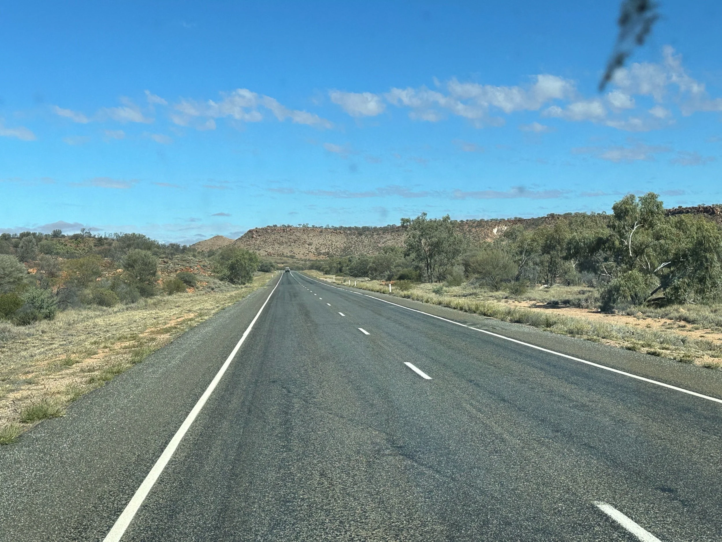
The Stuart Highway is the main (only) Highway that connects the South of Australia, up through the middle of Australia to Central Australia and up to the North tip at Darwin. None of it is dual carriageway and although not incredibly busy, you do have to squeeze past the massive Road Trains, articulated lorries with up to 4 sections and 50 metres in overall length.
These guys take no prisoners! We were crossing a narrow bridge over a creek where there was no possibility of pulling over, and a juggernaut came towards us on the other side and pressed on without pausing for breath. Of course it squeezed past but it was closer than we were comfortable with!
This road is 2722 kilometres long and we picked it up some way North of Alice Springs, having driven East - West from Brisbane along the Barkly Highway until it intersected with the Stuart Highway, running North - South. It roughly follows the trail of explorer John McDouall Stuart who goes down as one of the greatest Australian inland explorers. And we plan to follow it all the way down to Port Augusta before taking the Augusta Highway to Adelaide. We will deviate briefly to visit Watarrka National Park and Uluru before heading for Opal Mining Coober Pedy.

At this time of year (July) half of the traffic comprises caravanners driving North to find warm sunshine or Road Trains transporting goods, cattle, wool, cotton etc. We, however, are heading South, away from the sun towards more July winter weather! For now at least the winter warmers are stored away during the day, but sometimes dug out at night. Yes I have slept in a silk balaclava!
It is amazing to reflect that less than 200 years ago this through route was only just being created by the endeavors of early explorers. Whilst it is still fairly sparsely populated, (80% of Australians live near the coast) it is definitely accessible thanks to the bravery and determinations of these early explorers.

Stuart, for whom the road is named, was one of Australia’s principal explorers and responsible for navigating this vital North South route. He was challenged by the landscape which was in turns wet or dry as a dessert. He struggled to locate sufficiently well spaced watering holes on the route for their pack horses and team and scorching weather dried up creeks and potential water supplies. Bear in mind that their pack horses could only survive for two days without water, so he played leapfrog as he proceeded. Sallying forth to locate water for his party before returning and urging them to leave the last spot to march on to the next. There were also skirmishes with Aboriginal people, taking exception to their unannounced appearance in their traditional hunting grounds. Also Stuart’s food ran out and ill health took its toll on him and other members of his party. There were to be very many attempts before he and his party finally succeeded in making it all the way through in 1862.
And others exploring the centre in the same period, were less fortunate or penetrated less far than Stuart, and many lost their lives in the process. Another famous explorer Charles Sturt tried and failed to penetrate the centre in 1844. Another explorer around the same time trying to navigate East to West through the centre with 8 men, 13 mules, 12 horses, 59 bullocks and 270 goats completely vanished and none of them were ever found again. Burke and Wills took off in 1861 with camels, horses and wagons also intent on finding a crossing and they too perished.
The reasons for trying to open up routes were various, including looking for more potential pastures and mining opportunities but one of the most compelling was to create a route for the first telegraph linking the main Australian towns to the rest of the world. An underground cable was bringing the telegraph via India to Darwin but they were keen to link this cable to the rest of the country. Imagine, that at this time, news by letter took three months to reach Australia by boat from the UK. If the Telegraph was extended to Australia and within Australia, messages could be relayed within 24 hours.
Stuart did eventually succeed in 1862 after 11 or 12 attempts to reach Darwin from Adelaide, but sadly he was in such poor health on his completion and return to Adelaide that he was forced to retire back to the UK to be cared for by his sister and he died a few years later and is buried in London.
What is incredible is how recent all this was. And now thanks to these guys and their mules, horses and camels, we can travel North to South moving at 120kms an hour, except where the road is crossing one of umpteen creeks and has suffered from periodic flooding and is under reconstruction or repair.
Certainly driving along the Barkly Highway there were frequent signs advising us that the route between two points on this major highway, was passable. The implication being that there are times in heavy rains when the many dried up creeks or rivers (not all of them were dried up), became raging torrents and the main roads become inundated and impassable.

When you drive down the Stuart Highway you cannot but remember how recent and important this route is. Laybys have memorials to men who completed related Herculean tasks such as building a series of wells along the route which was essential for others following on.
These wells enabled settlements to be established and Telegraph lines and stations to be constructed and livestock farming to be developed.
Ned Ryan, a stone mason, is particularly remembered for the construction of wells between 1835 and 1893. Wells along this route he constructed from 1885. There are historic examples which can be viewed along the route. One of the early wells was at Alice Springs.


Evidence of this early exploration and development is signaled along the route.

Charles Todd who, thanks to Stuart and his team, would later in 1870/71 built the first Telegraph line linking Darwin to Adelaide. The effort involved in erecting telegraph poles and lines at high speed in inhospitable conditions where no roads existed was immense. Equipment was carted over roadless terrain by horses and bullocks. They had Afghan camel trains and 2,000 sheep to feed the workforce as the poles went up and the wires attached. The conditions were atrocious and the teams had to tackle floods and animals drowned and carts became bogged down laden with food or supplies of materials. In 1871 the cable linking Australia to the rest of the world landed in Darwin and a few months later (August 1872) messages could be sent right through to Adelaide, along the route that had originally been conceived by McDouall Stuart. There were 11 repeater stations to transmit the signals down the line and I believe three or four of these buildings are still existing (but not in use) today.
These old Telegraph stations built to pass the messages received onwards, can be found periodically and we visited a few that had been restored as local historical sites. The one above is the Tennent Creek station.
As I write on my iPhone and send blog drafts to Jim electronically to read. Or as I talk directly to my family in the UK or Switzerland over the internet, I cannot help but reflect on how people struggled to communicate in the early days. And how progress and the advent of the Telegraph depended on the huge personal sacrifices of many individuals. Also how in a sense it paved the way for the constant communication that we now take for granted in 2024.
Tennant Creek
The first stopover on our route South was Tennant Creek, traditionally owned by the Warumunga people. On arrival, we were greeted by a very smart new sign welcoming us to town. We pulled in at a friendly Tennant Creek Campsite for an overnight stop.
We had heard of the town because it was important to another set of Australian Cousins who had made their life together in this part of the Northern Territories. With the support of the Church, they had become immersed in an aboriginal community at even more remote Canteen Creek. They knew the town, its churches and community well.

For us, this was the first town we had stopped in, where there was genuinely a discernable Aboriginal presence. The town possessed modern municipal buildings some of which did not seem to be entirely operational! The town hall building looked expensive and the town had an open air pool which was shut when we arrived.
Also, it has to be said that commerce in the Main Street appeared to be struggling. Many premises were shut and we were unable to find a place to eat in town in the evening.
One of the few places that appeared to be thriving, (apart from the grocery store), was the liquor store. We were surprised to see that customers were being served through a drive through hatch and a friendly local policewoman was supervising proceedings.
Most of these tiny towns, do make the most of their assets and try to interest passing tourists. And in Tennant Creek it was to be the Art Gallery, which we had planned to visit which was closed for reconstruction and we had arrived too late to visit their Mining Museum which would have been interesting. If we had stayed longer we may have been able to locate the fossicking area where people are reported to still be finding the odd Gold nugget!
The impression we gained was that people (Aboriginal) appeared poor, probably out of work and that perhaps all was not well, in spite of evidence of substantial investment of public funds into enviable public buildings for a small town. More time would be needed for us to begin to understand the issues involved here.
We cannot understand why the vote for the Voice was rejected, when it potentially provided a route for greater Aboriginal input into public life. Because surely without it, the rest of us are not going to come up with the right solutions to these problems?
Cousins & Canteen Creek
My Cousin, Sue Davies and her husband Richard now live part of the year in Canteen Creek. Sue and I have Australian Grandparents in common. One of Richard’s lifetime projects is the translation of the Bible into a local language. This work has been supported by the Community, mentors and linguistic experts and by the churches with which they are associated. Their lives in Canteen Creek are so much more, as this is where they have lived for much of their adult lives, raising 5 children and immersing themselves in the minutae and fellowship of everyday life in a tiny community.
We would have loved to visit Canteen Creek but it was so remote that our 2WD van was not going to be able to navigate the roads so deep into the bush. However, we were both astonished and delighted that they opted to drive 187 kilometers (and three hours) each way across the Davenport National Park, to meet us on the Stuart Highway at the Devil’s Marbles Hotel in Wauchope, Davenport. There were old maps on the wall and you can see Canteen Creek on the right extremity.

We rocked up at the appointed time, and 10 minutes later they arrived with dusty wheels from deep kilometers away. We spent a happy time eating together and catching up on life and family things.
Now they are retired from full time Ministry, they live for half the year in a small unit in New South Wales. However, the pull of community remains strong and now they pitch up every year for months at a time in their off road camper to spend time on unfinished business and see friends. They feel at home and accepted. On our last visit to Australia,(5 years ago), we met up with them in New South Wales.
I imagine that their chosen path is now rare. But I believe, that for them, their mission has been rewarding and life enhancing. And what is certain is that they have gained knowledge and insights that few if any people not living in Country can possibly have.


Karlu Karlu - Devils Marbles
After our rendezvous with Sue and Richard was over, we needed to make tracks for our next destination, which was Alice Springs. But before we set off, we looped back to something that had caught our eye - Karlu Karlu or Devil’s Marbles.
I hope I can be forgiven for observing, that these very long driving days can be a bit unchanging. The landscape rarely has a mountain or lake or a geographical feature unlike the previous hundreds of kilometers. Much of the territory is flat and sometimes it is very scrub like and we see some cattle or other livestock and at other times there are eucalyptus trees, many of which are quite small but occasionally larger ones appear, probably alerting to there being a more reliable water source. So imagine our astonishment when these stones appeared at the roadside? We had to go and have a closer look.


We learned that these naturally occurring granite stones precariously balanced one on top of the other, had a cultural and ritualistic meaning to local Aboriginal people. And we felt happy to be permitted to explore. Richard told us that one stone had been removed to honor and mark the Grave of Flynn, (Flying Doctor pioneer) near Alice Springs. However this went down very badly with the local people who had not authorized this. Needless to say, that after much Aboriginal led negotiation, the offending stone has been restored to the site and another stone has been sourced, with Community approval, to acknowledge the Universal benefits that the flying doctor service has brought to all remote communities.

Aileron
Aileron isi the home of the striking giant figure of the 'Anmatjere Man' - a sculpture by Mark Egan that stands at 17m high and weighs a massive 8 tonnes!
The photo below shows the companion artwork created by the same sculptor Mark Egan, ‘Anmatjere Man’ was joined by a wife and child in December 2008. Unlike the original piece which took Mark Egan a year to create, ‘Anmatjere Woman and Child’ took only four months.
Next to these landmarks sits a Roadhouse where travelers can pause for refreshments or overnight.
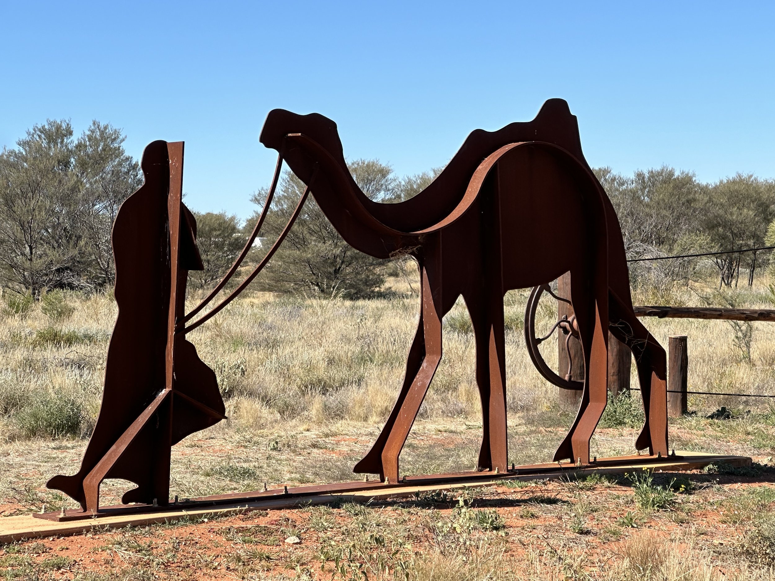
You get used to seeing camels in this part of the world. They were originally brought in from Afghanistan to help transport materials for construction of the telegraph and railways (Ghan railway). They now exist both in captivity and in the wild. They are suited to the climate but are considered to damage fragile dessert landscapes as they munch through vegetation including trees and grasses. Maybe that is why we are frequently offered camel burgers!


Alice Springs
We had set a few days aside to rest in Alice Springs after many weeks of driving. Our initial impressions were pleasing and we began to feel that we were about to witness some really striking geography. There were ranges of red hills or mountains really close to Alice Springs (McDonnell ranges). The town appeared quite substantial with ‘out of town’ car showrooms and industrial units, DIY shops and large supermarkets. Modern housing units were close to the centre of town tidily enclosed by quite tall fences. The town boasted many restaurants and shops and the camp grounds on the outskirts were high quality. On the first day we drove into town to explore, expecting to see restaurants and galleries and shops arranged around a town centre. We drove along pleasant busy roads by passing the centre along the tree lined Todd River creating pleasant public areas with shade. You are probably waiting for a but. And you would be right.
But we made the mistake of initially parking the van in an empty parking space outside a bar. We then noticed (lunchtime), scores of Aboriginal people crowding in and out of this bar and a security guard continuously counting people in and out. Then there were many people milling around on the streets outside and in and around all the public realm. People were not shopping but just socialising with family and friends. The atmosphere was not quite right. A bit tense and the town did not seem at ease with itself.
The high fences round flats and houses began to look more like security devices. The caravan park had locking security gates and there were signs everywhere about valuables and intruders. Caravanners told stories of people in vans being robbed in town at traffic lights. I hasten to add that nothing bad happened to us, but we left the centre quite quickly once we had taken stock and I only returned to use the main supermarket during our stay and other stores just out of the central area.
There was a busy Information Centre in town which was helpfully selling expensive tours and activities largely outside Alice Springs but also in Uluru. Staff loyally defended the town and failed to recognise that there were issues.
In town, we struggled to find the galleries advertised and places purporting to be galleries were largely shops selling Aboriginal dot art. We then found a modern Cultural zone in an out of the town park area. The opening times were quite limited and we failed to visit the main Gallery.
A couple of days after we had left, we learned that the Police in Alice Springs had requested a curfew, presumably to reduce the general milling around at all hours and cut out potential drunkenness in public areas and to help them reduce the potential for criminality and disorder. It was not a no go area. But at the same time it was not a ‘go to’ destination.
To us it seemed as if much of the visible population was Aboriginal and most of the people employed in shops or businesses, including the main Information Centre were not. We felt the area needed the right kind of help.

Out of Alice Springs we enjoyed visiting the Alice Springs Dessert Park which was fab for children with timed talks in different areas. We enjoyed their amazing falconry display and in the cafe we shared a camel burger and chips!


A trip out to visit the McDonnell ranges is a must. There are a number of walks and fab spots to visit. It was also delightful to be surrounded by a completely different mountainous landscape. The photo below was Ellory Creek watering hole accessible by road in the West MacDonnell National Park.


Visiting the memorial and Grave of Flynn - Flying Doctor fame. The flying Doctor innovation requires a blog of its own! Another pioneering innovator in this part of Australia.

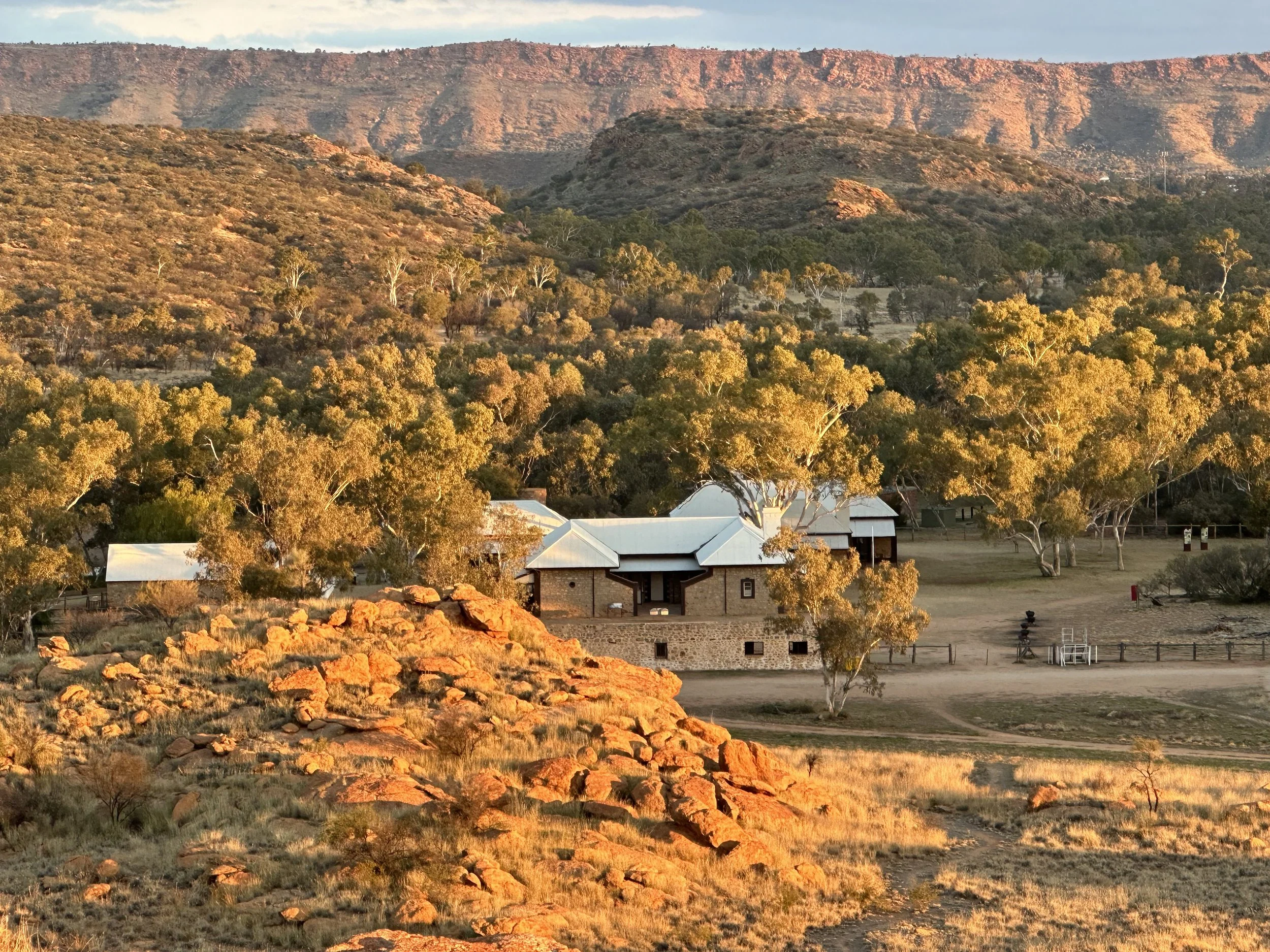
Alice’s own historic Telegraph complex and the neighbouring Trig point with the MacDonnell ranges in the background.